l'Europe du Nord en vélo et en trichant
120 days
5919km
+46615m
/ -46314m

Copier le lien ci-dessus (ctrl+c) et partagez-le où bon vous semble. Ou cliquez sur les liens de partage (fb/twitter)
![]()
![]()
traversée de l'Europe du Nord en vélo: Irlande, Royaume-Uni, Belgique, Hollande, Allemagne, Danemark, Norvège.
Cycling across Northern Europe: Irlande, United Kingdom, Belgium, Netherlands, Germany, Denmark, Norway
Cycling across Northern Europe: Irlande, United Kingdom, Belgium, Netherlands, Germany, Denmark, Norway
Activité :
travel bike
tekking/hiking
Statut :
done
Distance :
5919km
DATE :
5/6/16
Durée :
120 days
Dénivelées :
+46615m
/ -46314m
Alti min/max :
0m/848m


 Section 74
Mise à jour section : 11 Aug 2016
65km
+776m
/ -780m
8m/186m
vélo et un peu de rando
grand beau temps
72km D+ 950m 5h40
grand beau temps
72km D+ 950m 5h40
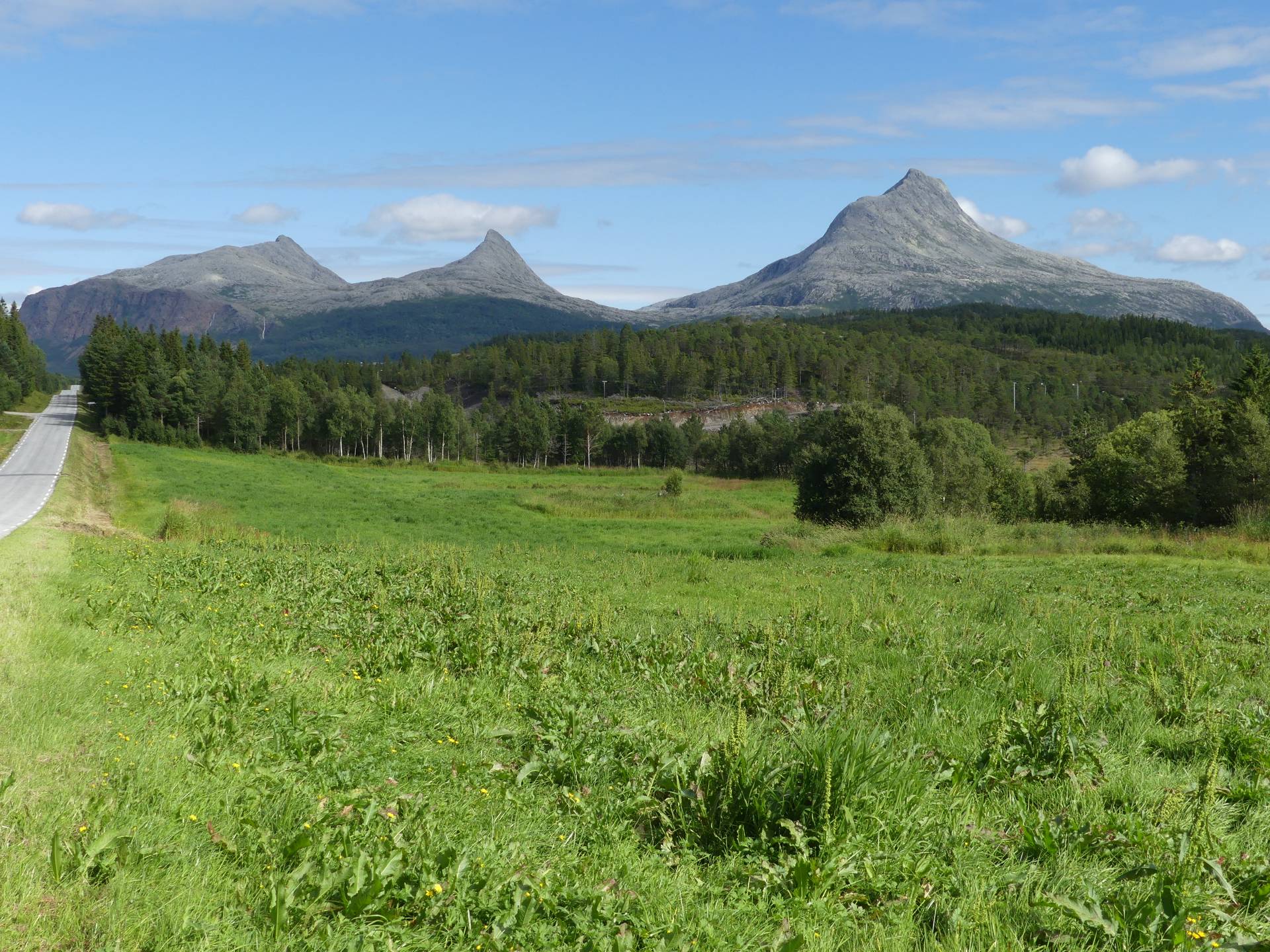
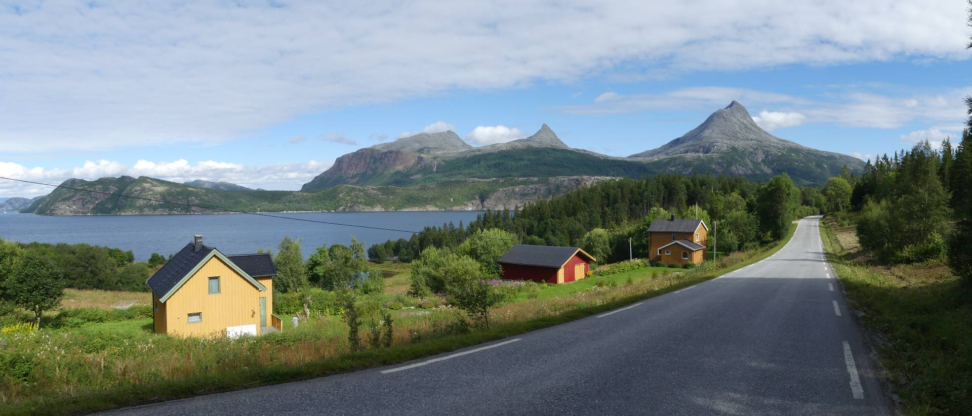
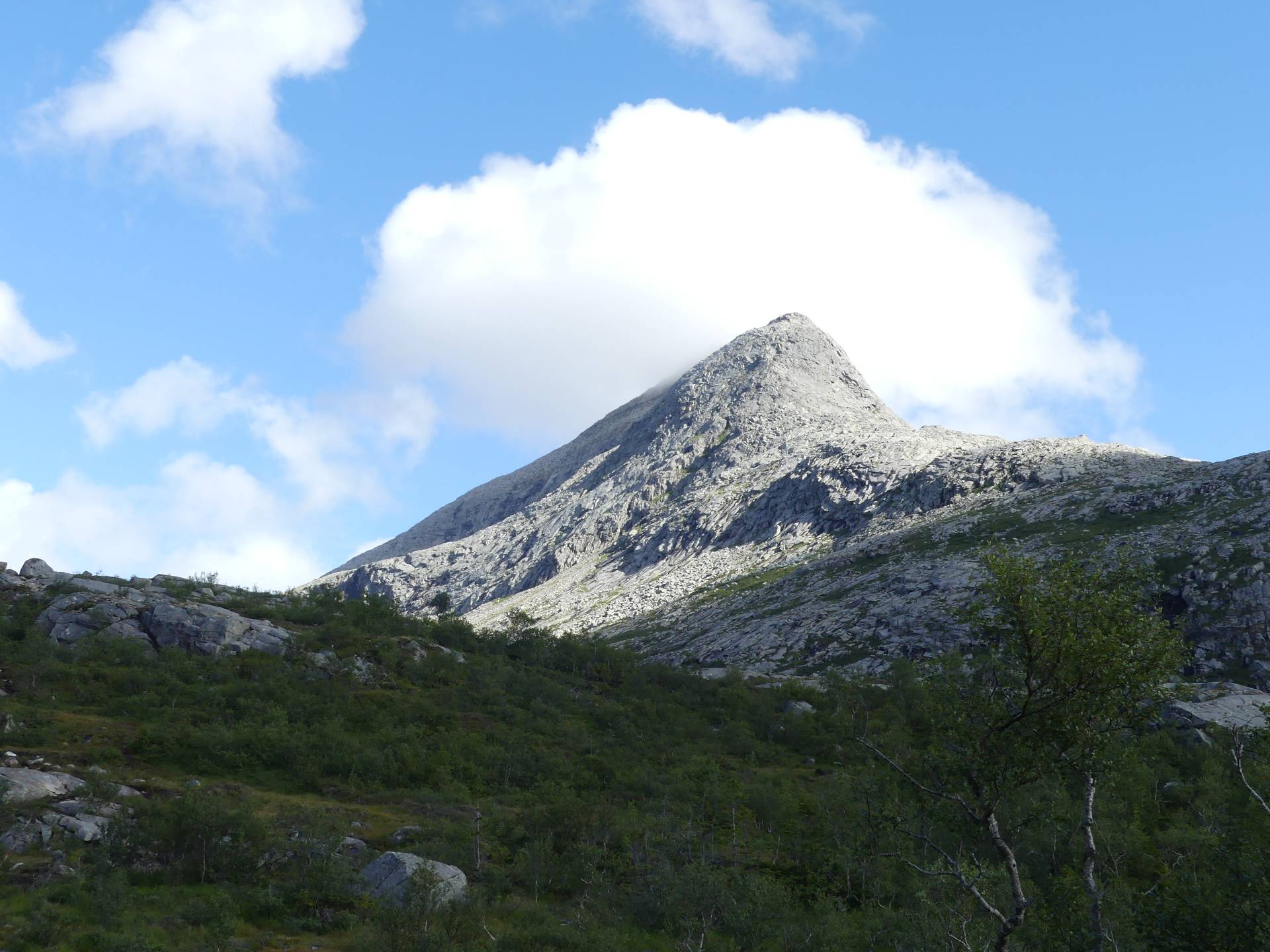
Plus j'avance, et plus les paysages sont beaux. Ca devient même carrément stupéfiant. Je reconnais un sommet dont m'avait parlé Berry, le Heilhornet. Il est trop tard quand j'y arrive pour en faire toute l'ascension, je me contente d'aller jusqu'au socle. C'est une très belle aiguille rocheuse qui se gravit par un sentier astucieux. 1000 m de dénivelé environ. Le bon plan est sans doute de dormir au camping juste avant.
Je prends mon ferry quotidien (cela devient une habitude) et campe juste à coté.
The more I go, the nicer the landscapes. It is really impressive. I recognise a summit Berry had talked to me about, the Heilhornet. It is too late for me to climb it, unfortunately, so I just walk until the view is nice enough to just stop and enjoy. It is a 1000 m climb, with a path. The best thing is probably to sleep at the camping ground just before, to have time to reach the summit. Really worth it because it is a very beautiful mountain.
I take a ferry and sleep just by the harbour.